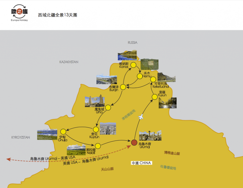
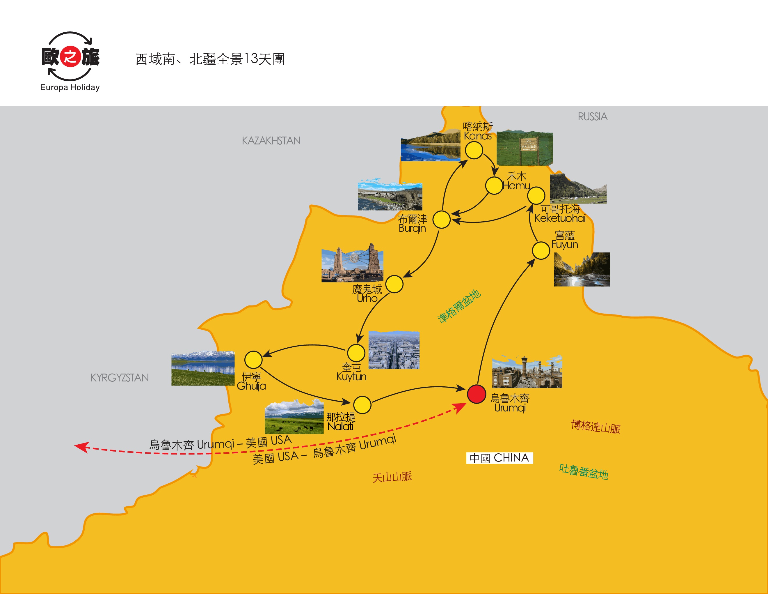
Northern Xinjiang & Silk Road 13 Day Tour
Summer 2019

*Huoshaoshan: Located in Changji Hui Autonomous Prefecture in Xinjiang territory Qitai Wucaiwan area. The difference between the Huoshaoshan and the Wucaicheng is that the rolling hills here are not colorful, but all are reddish by sinter. In the morning sun or the evening glow, it seems to be burning, hence the name.
*Wucaicheng: Walking into the colorful city is like walking into a dream world, and the strange colors come from all directions, which is dazzling. Among the various colors of cyan, black, red and green.
*Wucaitan: Colorful beach rock layer is composed of red, earth red, light yellow and light green sandstone, mudstone and glutenite, golden, brownish yellow, light yellow, rose red, brown red…. different colors, layered Stacked, colorful, and dizzying, it is called ” Colorful Beach ” and is known as “the most beautiful Yadan landform in Xinjiang.”
*Kanas Natural Landscape Reserve: Kanas Lake is located in the northern part of Brinjin, with an altitude of 1374 meters. It is located in the alpine lake in the dense forest of Altay. It is 10 times larger than the Bogda Tianchi and 180 meters deep. The lake will change color with the seasons and weather. It is a famous “color-changing lake”.
* One bottle of mineral water per person per day!
* Provide headset service for 15 and more guests per group for better sightseeing experience
★Entrance Fee and Transportation Included
Today fly to Urumqi, capital of Xinjiang Uygur Autonomous Region, located in the Tianshan Mountains, mountains with water, vast fertile fields, and native people here are affectionately called her “Urumqi”, meaning “beautiful pasture.” Urumqi is the farthest city in the world from the ocean. It is the geographical center of Asia and the only way to the world-famous “Silk Road”. Uygur, Han, Hui, Kazakh and other ethnic groups lived here and created a splendid ancient Western civilization. Numerous ethnic groups and different customs constitute the unique style of Urumqi. Urumqi has a magnificent natural landscape and a cultural landscape rich in regional ethnic characteristics.
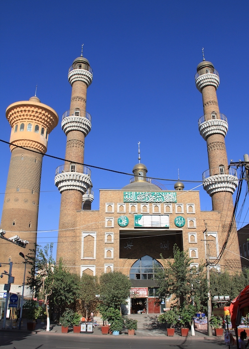
Urumqi is a multi-ethnic city. Upon arrival, if time permits can arrange to visit the Xinjiang Museum.
Dinner: Local Halal Cuisine
Hotel: Hilton Urumqi Hotel (5★) or similar
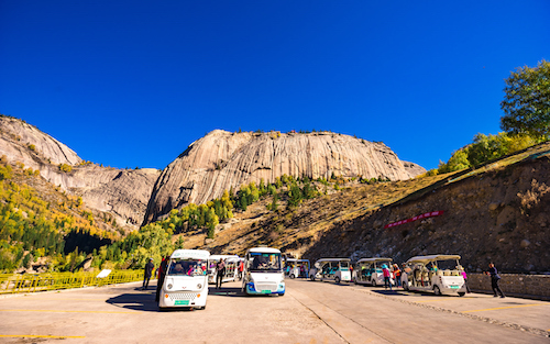
Leave Urumqi to Fuyun. Continued to the Keketuohai.
Kalamaili Nature Reserve ( via )
The Kalamaili Mountain is an east-west low mountain range. The land is complex, the vegetation is rich, the water source is sufficient, and the people are inaccessible, forming a paradise that is most suitable for wild animals to thrive. The reserve was established in April 1982 with a total area of 17,000 square kilometers. The rare animals that are protected by the state include Mongolian wild donkeys, “Pu’s wild horses”, argali, goose antelope (yellow sheep) and so on. Today, the main target of protection here is Mongolian wild donkey has grown to more than 700 heads, and the goose gazelle (yellow sheep) has more than 10,000 heads. In addition, wild camels, Platts wild horses, argali, rabbits and other rare hoofed wild animals, such as red dragonfly, golden eagle, giant salamander, sand pheasant, and reptiles such as sand lizards, have different degrees. Increased reproduction. National Highway 216, through this protected area, is very convenient for tourism.
Huoshaoshan (Burning Mountain)
Changji Hui Autonomous Prefecture is located within the territory Qitai Wucaiwan area, in Urumqi, the road to the 216 national highway in Altay, very bright. Qitai Huoshaoshan and Turpan Flaming different, due to the high temperature Flaming known world, and set fire to the mountain because of its famous mountain color, Wucaiwan in Qitai territory but also because of the color of the mountain and famous, Huoshaoshan The difference with the colorful city is that the rolling hills here are not colorful, but all are reddish by sinter. Look around and see almost no other colors. Every morning faint, in the morning sun or the evening glow, as if it is still burning, magnificent and rare, hence the name.
Breakfast: Hotel Buffet Lunch: Xinjiang Saute Spicy Chicken Flavor Dinner: Chinese & Lamb Cuisine
Hotel: Koto Sea Grand Hotel (local best) or similar
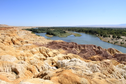
★ Keketuohai National Geological Park ( including shuttle )
The scenic area consists of four parts: the Irtysh Grand Canyon, the Coco Suli, the Iremut Lake, and the Karasenger earthquake fault zone. It beautiful river valleys, rocks forest land, mineral resources, extremely cold lakes and exotic earthquake fault natural scenery. Passing through the Karajanger earthquake fault zone, the seismic fault zone runs along the crack and stretches vertically. The Karasenger earthquake fault zone is one of the rare earthquake fault zones in the world and is known as the “Geological Museum”. Coco Suri Lake, also known as the Wild Duck Lake, is known as the Baiyangdian Lake. There are more than 20 floating islands in the lake. The reeds float on the water, drifting with the wind, the wind is a scene, and the scenery of the lake changes. Every summer and autumn, thousands of wild ducks, water chickens and red geese gather here to thrive. Yeyahu both delicate and beautiful West Lake, there Baiyangdian reed marshes maze, on the open and flat grassland of more than 10,000 acres on the other side of the lake, there are scattered groups of cattle and sheep, stalking the flowers and grass, quiet and comfortable, which makes people feel that nature is so delicate and perfect.
★ Wucaitan
Known as “the first beach in the world”, it is the only river that has been injected into the Arctic Ocean – the Irtysh River passes through it. Colorful beaches on both sides of the river, north and south. On the south bank, there are oasis, desert and blue sky, and the scenery is unobstructed. North Shore, it is a cliff-like Yadan landform, with undulating hills and varying colors. It is formed by a fierce stream erosion and a violent wind erosion. Due to the uneven strength of the weathering resistance between riverbanks, the unevenness of the contours is formed. The color of the rocks here is changeable, and under the sunlight of the setting sun, the color of the rocks is mainly red, with green, Yellow, white, black and transitional colors, colorful and charming, it is called “Colorful Beach” and is known as “the most beautiful Yadan landform in Xinjiang.” “Landform” pinnacle in size, stone walls, pillars, peaks such as forests, Aioi density within the area, the atmosphere glory, rigid full, the odd shape Yan, dust is not stained, vulgar extraordinary off, unique, gods, Form a magnificent picture of the Jinxiu Mountain River.
Breakfast: Hotel buffet Lunch: Chinese Cuisine Dinner: Cold Fish Cuisine
Hotels: Burqin Tourism Hotel (local best) or similar
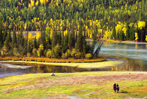
★ Kanas Natural Landscape Reserve ( including shuttle car ). Moon Bay
Kanas is Mongolian, meaning “beautiful and rich, mysterious and unpredictable”. The lake is 1374 meters above sea level. It is a mountain lake located in the dense forest of Altay. It is 10 times larger than the famous Bergda Tianchi and the lake is the deepest. It is about 180 meters. The lake is surrounded by blue waves and peaks. The lake will change color with the seasons and weather. It is a famous “color-changing lake”. A meniscus-shaped Kanas Lake, Lake east coast of the inner side of the meniscus, along the shore of the six projecting platform lake, lake formed so orderly 6 bay. Each Bay has a magical biography said. This is a resort for photography enthusiasts. From spring to autumn, from early morning to evening, under the influence of different climatic effects and light, the water and moon are constantly changing the mysterious charm of Yan Rong, providing photography lovers with A wonderful picture. In the landscape pictures of Kanas, the beauty of Moon Bay accounts for a large proportion. Moon Bay is a river bay on the Kanas River, located above Wolong Bay. Due to the difference in the bottom of the lake and the change in the amount of water coming from the upstream and the influence of light, Moon Bay presents a magnificent and varied color. Moon Bay’s quiet off the vulgar will make people see her involuntarily relaxed mood, like two feet of water central Indian island, but gives unlimited imagination.
★Wolong Bay
Located in the valley of the Kanas River, it is a series of tortuous river bays formed by the long-term erosion of the Kanas River. Boarding the platform next to the east side road, overlooking the omega-shaped meandering panorama, just like a dragon and a dragon lying in the water, Wolong Bay got its name. The river beach is full of green grass, wild flowers and luxuriant, cattle and sheep in groups, and the ancient trees on both sides of the river bay are towering. Over the treetops, you can see the layers of mountains and rivers, and the scene is full of vitality.
★Shenxian Bay
It is actually a swamp shoal formed by the Kanas River at a low level in the foothills. Under the sun, the river is full of brilliance. Even the leaves on the trees are swaying and sparkling with the wind. It seems that countless pearls are scattered at will. Plus here often misty, vulgar off extraordinary, dreamlike, people looked immersive wonderland general.
★Guanyuting ( including shuttle car )
Located on the top of the camel peak on the west bank of Hanas Lake, at an altitude of 2030 meters, the height difference from the lake is 600 meters. The observation of the fish pavilion is to observe the “lake monster” in the lake, which is commonly known as the red fish. Although there are few people who can see the red fish, it is the best angle to overlook the panoramic view of Kanas Lake. The snow-capped mountains, green forests and turquoise lakes are all in sight, so visiting the fish pavilion is still a must for visitors to Kanas. One can take a bird’s eye view of Kanas Lake, and three-quarters of the lake has a panoramic view. The second is to see the beautiful mountains and lakes on the lake, the peaks of the Cuifeng, and the beautiful mountains and clouds. The Kanas Lake waters from the south to the north are blocked by the mountains, and the mountains are clear. I saw the highest peak of the Altai Mountains – Friendship Peak (4374 meters) .
Breakfast : Hotel Buffet Lunch: Chinese Cuisine Dinner: Chinese Cuisine
Hotel: Jia Deng Yu Four Seasons Leisure Hotel (4 ★) or similar
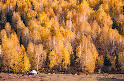
★ Kanas Lake Cruise Sandaowan
Arrive lakeport and take a cruise tour at Sandaowan, according to the scientists, the so-called “lake monsters” is a big redfish called the taimen. On the cruise ship, sitting on the boat and watching the two sides, the feeling is indeed different. Vision becomes open up, the lake is very wide, there are bursts of breeze blowing, both sides of the mountain at this time appear to be tall and up, the horizon of a cloud suspended above a lake shore Tuva people chalet seemed so Quiet. Kanas Lake is like a three-dimensional oil painting. When you are in it, you can turn it around and you will see a beautiful oil painting.
In the afternoon, transfer to Hemu.
Breakfast : Hotel Buffet Lunch: Chinese Cuisine Dinner: Chinese Cuisine
Hotel: Hemu Mountain Villa (4★) or similar
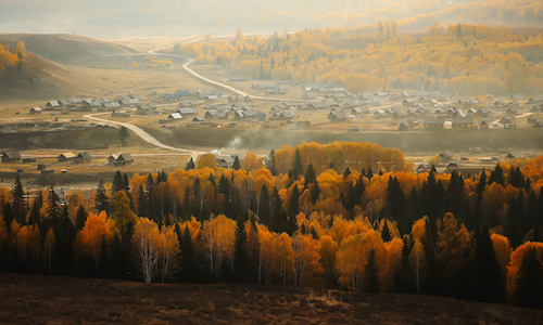
★ Hemu Village ( including shuttle car ). Tuva Tribe
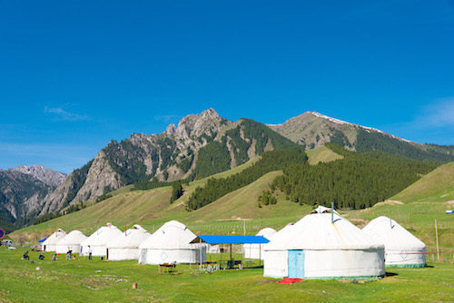
Hemu Village is the concentrated living place of the Tuva people. It is the farthest and largest village among the only remaining Tuva villages (Hemu Village, Kanas Village and Baihaba Village) with a total area of 3,040 square kilometers.The houses here are all made of logs and are full of original flavor. The most famous of Hemu Village is the intoxicating autumn colors of Wanshan Red. The smoke rises in the autumn colors, forming a dreamy smoke belt, which is better than a fairyland. On the hillside around Hemu Village, you can overlook the panoramic view of Hemu Village and Hemu River. The Tuva tribe – the inhabitants are Tuva who claim to be Mongolian. Their ancestors migrated from Siberia 500 years ago and belong to the same ethnic group as the Tuva of the Tuva Republic of Russia. The houses of the Tuva are built of logs, and the lower part is a square body with a pointed structure. The yurt is still in the nomadic pasture.
After lunch, leave grassland, returns Burqin.
Breakfast : Hotel Buffet Lunch: Chinese Cuisine Dinner: Grilled fish Cuisine
Hotels: Burqin Tourism Hotel (local best) or similar
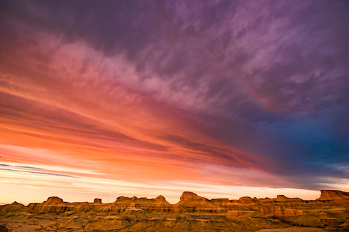
Go to Daosu and pass through the Devil City.
★Ulhe Devil City (including battery car in the scenic area)
“Yadan” is a term for geography, meaning “dangerous mound” in Uighur, which refers to a special landform in a dry area. It is the evolution of the plateau-shaped platform portion are configured desert bedrock fractures or joints, such storm erosion cracks widened expanded, since after the wind erosion continues, gradually wind erosion valleys and depressions are formed, island-like platform hill It turns into a stone pillar or a stone pier. Such a place is like an abandoned empty city. It is called “Dragon City” in the ancient book. The ground in the Devil City is cracked, and some small bushes such as camel thorns are scattered on the ground. The table-shaped mountains made of blush and gray-green rock formations, after millions of years of water erosion and sandstorms, look like ancient cities, fortresses and palaces, as well as many vivid landscapes. The wind blowing along the valley, rolled gravel audible shrill, like a wolf howling ghosts, “Ghost City” name is derived from this. Known as the Natural Museum, the scenery is unique, and many movies have regarded the Devil City as a location, such as the Oscar-winning film Crouching Tiger, Hidden Dragon. The landform was selected as the “China’s three most beautiful Yadan” by the “National Beauty China” campaign of China National Geographic.
Breakfast : Hotel Buffet Lunch: Stew Lamb Cuisine Dinner: Chinese Cuisine
Hotel: Haofeng International Hotel (local best) or similar
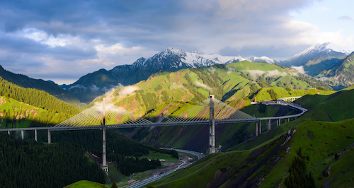
After breakfast, proceed to Sailimu Lake. Route to the Genggou Bridge and continue to Yining, the capital of the Ili Kazakh Autonomous Prefecture.
★ Sailimu Lake Haixi Scenic Area (including traffic in the scenic area)
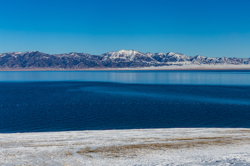
Saili is a Kazakh language, meaning “good wishes”, and it also has a common name called “Santai Haizi.” Sailimu Lake is like a sapphire embedded in the West Tianshan. The lake is surrounded by beautiful pastures with abundant water and grass. At an altitude of 2073 meters, the lake is slightly oval, 20 kilometers from east to west, 30 kilometers from north to south, with an area of 454 square kilometers and a depth of 86 meters. It is the highest alpine cold water lake in Xinjiang. Sailimu Lake is a cold water lake. (When you wash your hands in the lake in the summer, you will feel some bitter water.) The lake is quiet and blue. The lake is surrounded by silence. You can only hear the sound of the grass and the hillsides and the occasional cattle and sheep. The lakeside grasslands are excellent summer pastures. From the end of July to the beginning of August each year, local Mongolian and Kazakh herdsmen will hold the Nadama event here.
Fruit Ditch & Bridge
With a total length of 28 kilometers, the mountains are high and the spruce is dense. The Uy Road is in the beautiful valley. It feels like flying in the air in the car. The top of the head is the blue sky and the tip of the mountain. It looks like a matchstick. The fruit ditch is a natural treasure house endowed by nature. There are countless wild fruits, and the resources of the medicinal materials are also very rich. From the spring to the autumn wild flowers, the fruit is rich and fragrant, and it is a veritable “fruit ditch”. The bridge of the Guogou Bridge is 700 meters long. The bridge deck is 200 meters away from the bottom of the valley. The height of the main tower is 209 meters and 215.5 meters respectively. The main bridge of the bridge is made of steel truss structure. Autonomous Road Bridge is the first cable-stayed bridge, but also the highway’s first National towers steel girder double cable plane cable stayed bridge. As the first cable-stayed bridge and the first high bridge in Xinjiang, the Guogou Bridge is the largest and most important bridge in Xinjiang. It is also the country’s first highway steel truss cable-stayed bridge, which integrates new technologies, new structures, new processes and new equipment. The four new ones are a major breakthrough in the history of highway construction in Xinjiang. The completed bridge and the beautiful scenery of the fruit ditch will add a beautiful scenery to the Guogou National Scenic Area.
Breakfast : Hotel Buffet Lunch: Chinese Cuisine Dinner: Chinese Cuisine
Hotel: Yining Meijing Hotel (local best) or similar
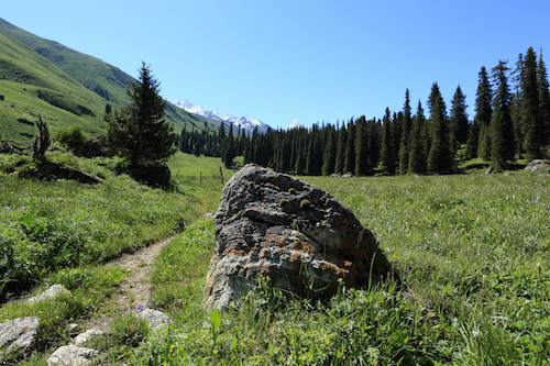
Transfer to the Nalati grassland today.
★ Nalati Grassland (including traffic in the scenic area) is one of the four grasslands in the world. It is like a huge aerial garden. In spring and summer, the grass is high and beautiful. It is extremely beautiful. In the history, the Nalati grassland is also known as the “Deer Garden”. After six months per year into the large group of livestock, flowers and grass prairie sheep, horses play chase, yurts and white clouds constitute a picture of an attractive landscape. There are flat river valleys, high mountains and deep gorges, and lush forests. The grasslands stretch and reflect each other beautifully.
Breakfast: Hotel Buffet Lunch: Xinjiang Pork Cuisine Dinner: Wild Mushrooms Stewed Chicken Cuisine
Hotel: Narathi Sky Prairie Holiday Inn (local best) or similar
Return Yining today, then afternoon fly to Urumqi.
Breakfast : Hotel Buffet Lunch: Chinese Cuisine Dinner: Chinese Cuisine
Hotel: Hilton Urumqi Hotel (5 ★ ) or similar
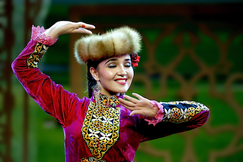
Today, to the Tianshan Grand Canyon . In the evening, arrange to enjoy the wonderful Xinjiang folk song and dance performances.
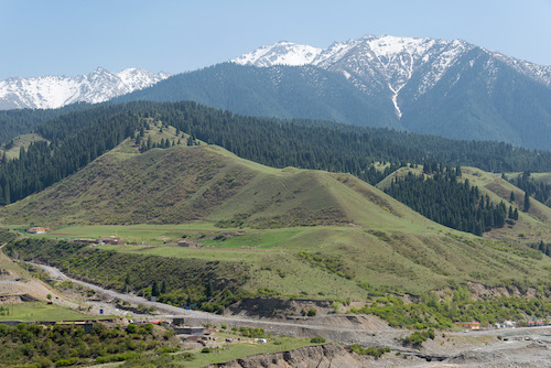
★ Tianshan Mysterious Grand Canyon (including scenic transportation) in the north of Kuqa County, Aksu Prefecture, 72 km at 217 State Road, east to west in a depth of about 5.5 kilometers, rain carved from red-brown rock carved by the wind, Labyrinth Canyon Passing through, there is no hole in the sky, the mountains are in various poses, the peaks are straight into the sky, there are trenches in the ditch, and there are valleys in the valley. The landscapes of Nantianmen, Ghost Valley, Crescent Tooth Gap, Huya Bridge, Motian Cave, and Xiongshi Tears are vivid. 1.4 km away from the cliff at the Tang Dynasty Taniguchi has a grotto, cave south, north, west wall there are remnants of murals and Chinese text. There is another canyon 700 meters away from the canyon, accompanied by the mysterious canyon. Tianshan Mysterious Grand Canyon set-hung, insurance, quiet, quiet, God as a whole, immersive who called all praise must. In January 2002, it was promoted to the national AA-level tourist scenic spot. A new pearl has been added to the ancient Silk Road gold tourism line. The Grand Canyon is roughly curved in the north-south direction. The opening is slightly curved to the southeast. The end is slightly curved to the northeast. It consists of the main valley and the seven valleys. It has a total length of more than 5,000 meters. The natural drop from the valley end to the valley is more than 200 meters. The bottom is the widest. Meter, 0.4 meters at the narrowest point, only one person bowed his head and passed sideways. On the side of the valley, the peaks and peaks are vying for rise, cliffs and rocks, steep and majestic.
Breakfast : Hotel Buffet Lunch: Ban Noodle Cuisine Dinner: Western Farewell Dinner
Hotel: Hilton Urumqi Hotel (5★) or similar
End of the wonderful trip to northern China and look forward to seeing you next time!
Breakfast : Depending on the time of departure
This trip is a journey of in-depth, combined with the overall travel environment in Xinjiang, such as hotels, toilets, restaurants, etc., cannot be compared with developed tourist places, so please be prepared.
Kanas Lake is about 1380 meters above sea level (about 4554 miles), Sailimu Lake is about 2080 meters (about 6864miles), and Nalati grassland is about 1300 meters to 1500 meters (about 4,290 miles – 4,950 miles). ), Karakuri Lake is about 3,600 meters above sea level (about 11,880 miles). Usually, although there is no altitude sickness, please choose the appropriate travel plan according to your physical condition. When you visit, please be sure to be based on your physical condition.
*Min. 16 people
Tour Fare include: 5 star Hotel or special lodge, Breakfast, Lunch, Dinner, Local Transportation, Entrance Fee
Tour Fare excludes: AIRFARE, Personal expense, Any expense not included in our itinerary, Tips: USD $10 per day, Visa Fee, Travel Insurance(If full payment paid 60 days prior to departure date, we offer medical travel insurance for US residents only)
** If you purchase air ticket on your own, your arrival time to the first destination and your departure time from last destination to U.S. must be the same as our group. If not the same, you must arrange your own transportation to meet group and to aiport on the last day **
Notes:
*Tour fare is per person in double occupancy
*Child Fee: 2-11 years old share bed with parents, otherwise will be count as adult fare
* Single supplement is for one person occupying one single room with one bed
*Tour fare, air ticket, airport tax and fuel surcharge are subject to change base on fluctuation in price, please contact us for more info

